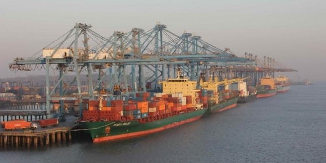
Sagarmala Project
- It is a series of projects aimed at harnessing Sagarmala Project the country’s 7,500 Km long coastline and inland waterways for industrial development.
- Sagarmala, integrated with the development of inland waterways, is expected to reduce cost and time for transporting goods, benefiting industries and import/export trade.
- It is a huge project with 150 initiatives and a total outlay of Rs. 4 lakh crore. The projects have been identified across the four broad areas of:
- Modernize port infrastructure, add up to six new ports and enhance capacity. (Port modernization and new port development)
- Improve port connectivity through rail corridors, freight-friendly expressways and inland waterways. (Port connectivity enhancement)
- Create 14 Coastal Economic Zones or CEZs and a special economic zone at Jawaharlal Nehru Port Trust in Mumbai with manufacturing clusters to enable port-led industrialization ( CEZ is an effort to reduce cost by locating manufacturing centres closer to the ports, thereby making Indian trade competitive in the global market). (Port-led industrial development)
- Develop skills of fishermen and other coastal and island communities. (Coastal community development)
- To implement this, State governments would set up State Sagarmala committees, headed by the chief minister or the minister in charge of ports.
- At the central level, a Sagarmala Development Company (SDC) will be set up to provide equity support to assist various special purpose vehicles (SPVs) set up for various projects.
Why is it important?
- India is located along key international trade routes in the Indian Ocean and has a long coastline of over 7,000 Km.
- Yet, capacity constraints and lack of modern facilities at Indian ports tremendously increases the time taken to ship goods in and out of the country. This has held back India’s share in the world trade.
- Transportation by waterways has historically remained under utilized in India although waterways are significantly cheaper compared to road and railways
- Developing rivers as inland waterways can also help save domestic logistics cost too.
- Port infrastructure and linkages are in a bad state and initiatives like Make in India cannot take off without these.
- It is expected that the Project could boost India’s merchandise export to $110 billion by 2025 and will create around 10 million new jobs.
National Perspective Plan (NPP)
- The Sagarmala National Perspective Plan was released in April 2016.
- This plan is based on four strategic levers-1. Optimizing multi-modal transport to reduce the cost of domestic cargo,2. Minimizing the time and cost of export-import cargo logistics,3. Lowering costs for bulk industries by locating them closer to the coast,
4.Improving export competitiveness by locating discrete manufacturing clusters near ports.
- The Sagarmala NPP identifies specific opportunities for transportation of commodities such as thermal coal, fertilisers, foodgrains, cement and steel by coastal shipping and Sagarmala Project inland waterways.
National Waterways (NW) of India
NW-1:
- Allahabad-Haldia stretch of the Ganges-Bhagirathi-Hooghly river.
- Length is 1620 Km.
- Established 1986.
NW-2:
- Sadiya- Dhubri stretch of the Brahmaputra river
- Length 891 Km.
- Established 1988.
NW-3:
- Kollam-Kottapuram stretch Sagarmala Project of West Coast Canal and Champakara and Udyogmandal canals
- Length 205 Km.
- Established 1993.
NW-4:
- Kakinada-Pondicherry stretch of canals and Kaluvelly tank, Bhadrachalam – Rajahmundry stretch of River Godavari and Wazirabad- Vijayawada stretch of River Krishna
- Length 1095 Km.
- Establishes 2008.
NW-5:
- Talcher-Dhamra stretch of rivers, Geonkhali- Charbatia stretch of East Coast Canal, Charbatia- Dhamra stretch of Matai river and Mahanadi delta rivers
- Length 620 Km.
- Established 2008.
NW-6:
- Lakhipur- Bhanga Sagarmala Project stretch (Assam)
- Length-121 Km of the Barak river.
- Established 2013.
